The Oregon version of Lolo Pass offers some gorgeous views of Mount Hood. We are looking at the west face of the mountain from about six miles from the peak, almost close enough to reach out and touch.
To find the Lolo Pass road take Highway 26 east from Portland. About a mile past the Hoodland traffic light, just opposite of the Zig Zag Ranger station look for the turn off to the Lolo Pass Road. Once the road enters the Mount Hood National Forest it becomes a narrow paved road that could use some improvement. After reaching the summit turn sharply to the right… The Pacific Crest trail is accessible at this point… off road parking is available… GPS coordinates are: 45.427141 -121.796264 elevation 3,440 feet… The gravel road continues for several miles before reaching one lane pavement again.
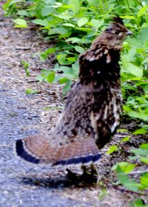
Ruffed Grouse Lolo PassShortly after reaching gravel we saw several ruffed grouse picking gravel roadside. No chicks in tow but a great display of ruffed feathers by the one pictured.
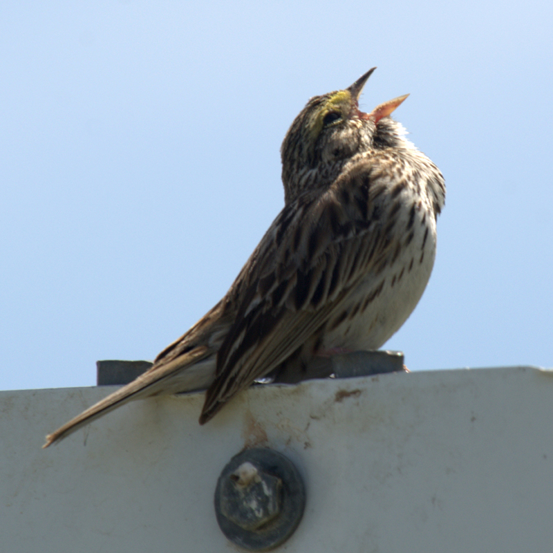
A Savannah Sparrow was perched roadside at the Ridgefield National Wildlife Refuge yesterday, 4 June 2013, and singing so we recorded the song. The frequency is pretty high so we are calling this a hearing test. If you don’t hear it the track runs for about 45 seconds.
With record setting low daily high temperatures and rain the last couple of weeks the prospect of better weather with sun breaks tempted me to go bird watching at Ridgefield National Wildlife Refuge in Clark County, Washington yesterday, May 30, 2013. It rained most of the hour long drive to Ridgefield but once there the clouds parted and the sun started warming things up.
Yellowheaded Blackbird Ridgefield NWR
Marvin Kellar met me at the kiosk and we proceeded with the auto tour. Red-winged blackbirds were in abundance with a few Yellow-headed blackbirds mixing in. They were perching on the Cat-tails and regaling each other with song.
We saw, but did not photograph, a Belted Kingfisher. They are rather camera shy.
We decided to hike the Kiwa trail, a short mile and a half loop walk through a grove of Ash trees. The trail passes along a slough for a distance and then circles some small marshy lakes before returning to the beginning. A Kingfisher tantalized us by flying short distances, just out of camera range, as we approached.
It was now a little past noon and songbirds were in fine tune. We spotted one of the culprits, a Black-headed Grosbeak, outfitted in breeding colors, perched about 20 feet up in a tree. Tree swallows were flying about and seemed oblivious to our presence… even posing for the camera. About half way around the loop trail a heavy rain shower caught us in the open… nothing to do but cover our camera gear and plod through the pelting rain back to the car, protecting our camera gear as best we could.
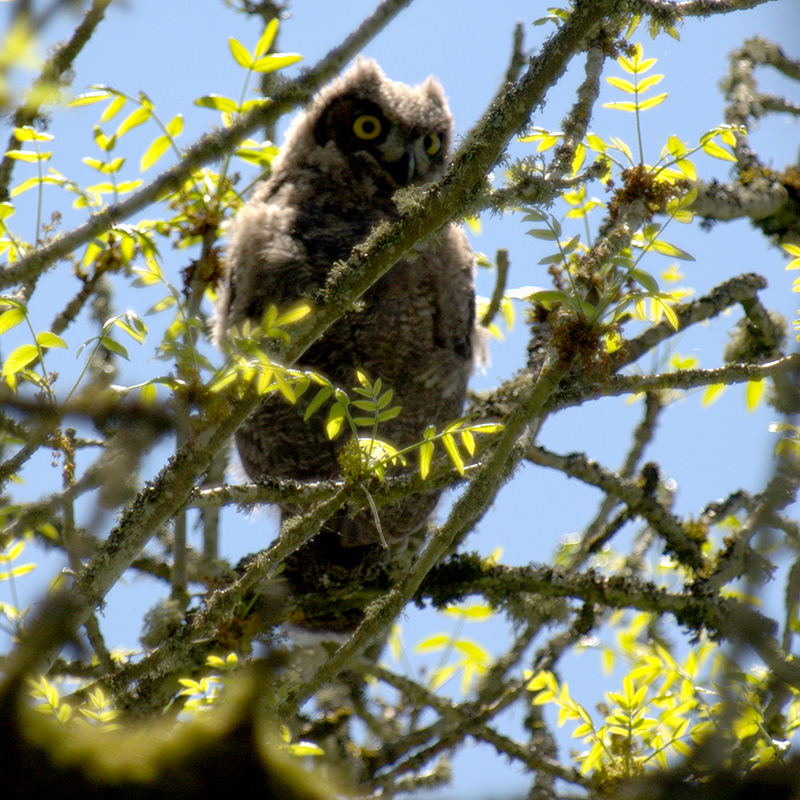
Great Horned Owl Ridgefield NWR
As we continued the auto tour, now in a grove of Ash trees, Marvin spotted a bird-like lump in a tree across the slough on our right. Out came the binoculars which revealed a Great Horned Owl chick. Although it looked capable of flight it seemed content to sit and watch us take pictures. We were delighted with the find. Owls are a special treat in the daytime. Lighting conditions were not optimum so we spent some time trying different camera settings, hoping for that one spectacular photo. After exhausting our appetite for owl pictures we continued the tour.
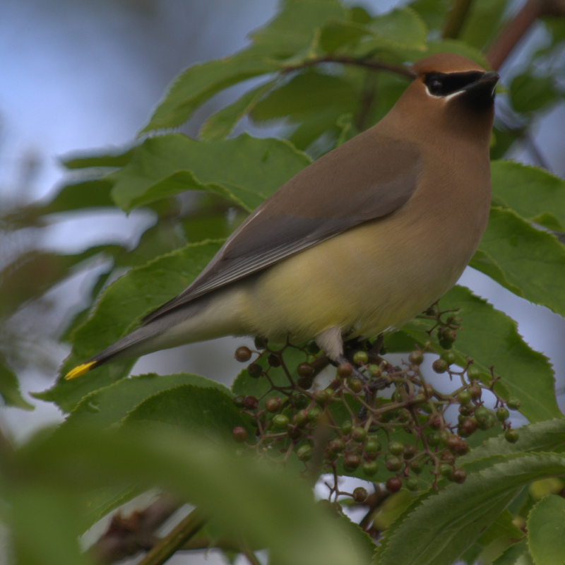
Cedar Waxwing Ridgefield NWR
A roadside Blue Elderberry bush provided several Cedar Waxwings close and just above eye level. They were busy foraging for berries (not yet ripe) and our presence didn’t bother them. We were congratulating ourselves on our good luck finding some birds that were not the everyday, everywhere American Robin.
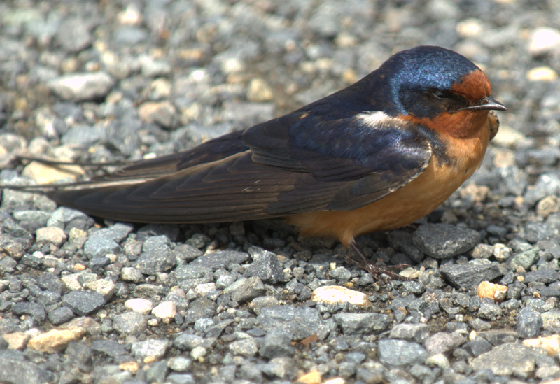
Barn Swallow (Hirundo rustica) Ridgefield NWR
The sun was shining once more and Barn Swallows were landing in the gravel of the road. They were hunkered down, apparently soaking up the sun’s heat from the gravel. We had to be careful to not run over one of the little guys but they were giving us great opportunities for some up-close and personal photos.
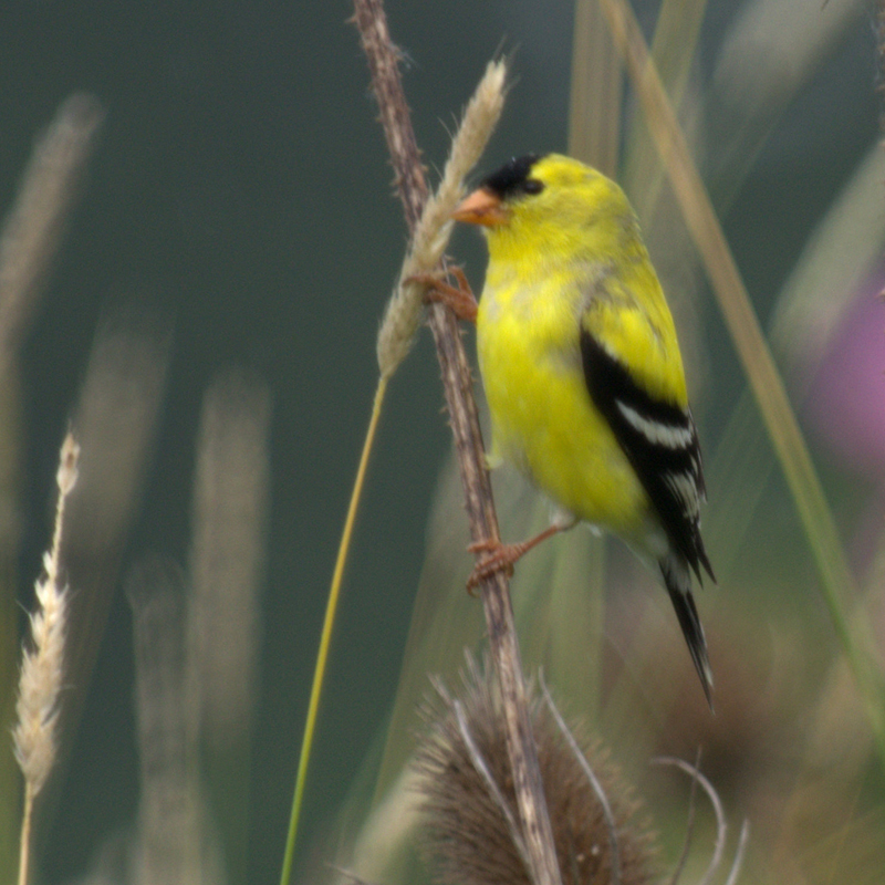
American Goldfinch (Carduelsis tristis) Ridgefield NWR
Near the end of the loop the road passes along a dike where numerous Teasel stalks left over from last year form a thicket. A flock of American Goldfinch were perching on the Teasel and picking grass seeds from Canary Reed grass growing alongside. Notice how the Goldfinch is pinning the grass stalk against the Teasel.
Having completed the first loop we opted for one more trip around, maybe our good luck would continue.
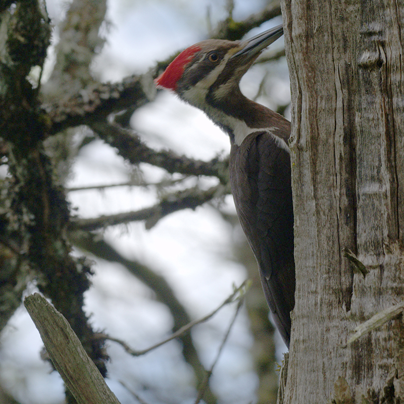
Pileated Woodpecker Ridgefield NWR
And it did… back in the grove of Ash trees a Pileated Woodpecker flew up and landed on a tree not ten feet from the car. After the shock of seeing it I fumbled with my camera, trying to make it focus on this elusive bird, and missing the greatest opportunity for the classic woodpecker pose. After finally remembering I had changed the focus to manual I recovered and got a couple nice shots of the big red head. It quickly tired of the commotion it had caused and departed our vicinity. We were at least a mile from any conifer so we were surprised to see this particular species in a deciduous forest. The rumor is they require old growth timber but the truth is they can be found almost anywhere. Still, sightings are rare and exciting when they happen.
A traffic jam ahead alerted us that the owl was still hanging out in the tree across the slough. This time there were two owls… an adult was perched next to the chick. When we got our turn we snapped a few dozen more pictures. Another car stopped behind us and the guy driving got out with a tripod and a camera with one of those $20,000 telephoto lenses attached. The adult owl decided enough was enough and departed, leaving the chick to fend for itself.
We departed too… and found our smallest falcon, an American Kestrel, perched on a roadside signpost. It teased us by flying just one post ahead, stopping until we almost got in camera range and then flying to the next perch.
We called it quits… a fine day out birding… and quite an exciting day at that.
The Big Bottom Wilderness Area came into being in 2009. Located on the Clackamas River about 42 miles from Estacada it can be approached most easily by following State Highway (SH) 224 to Ripplebrook Guard Station and then Primary Forest Route (PFR) 46. Turn right on a Secondary Forest Route (SFR) 4670, cross the bridge over the Clackamas River and turn right on the gravel road leading down river. Travel about a mile and park at a spur road leading downhill. The immediate area has been freshly logged so road signs may not be available but on a map the parking area will be road 120. A “big tree” adventure awaits you about a mile down this old logging road.
Larry Rea Hiking Big Bottom Wilderness Clackamas County
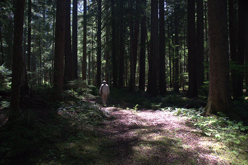
My son and I hiked into the area to look for some of Oregon’s biggest old growth trees. It would be difficult to get lost in this small wilderness area but to be on the efficient side it would be a good idea to carry a compass. Thrashing around in the brush can get confusing (and frustrating). If you stay on the old roadbed you will miss seeing the Big Trees although it is pleasant in the grove of old growth trees along the river.
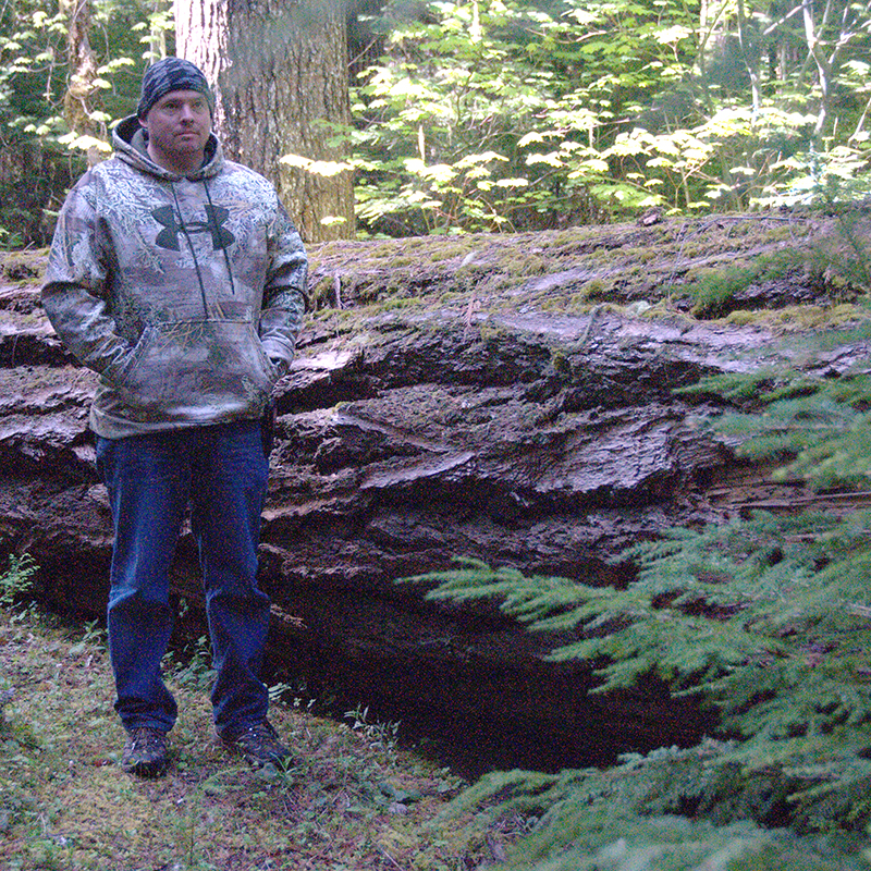
Chris and windfall tree Big Bottom Wilderness; Clackamas County
This fallen tree won’t set any size records but does create a formidable barrier to travel.
I wonder if it made any sound when it fell. We did hear the sound of limbs falling while we were hiking around. The wind wasn’t blowing… that would have made me nervous… and some of the trees lean at seemingly impossible angles. Given the number of fallen trees one might wonder if root rot is a problem in this grove.
At any rate on a nice spring day a hike in these woods can be quite enjoyable.
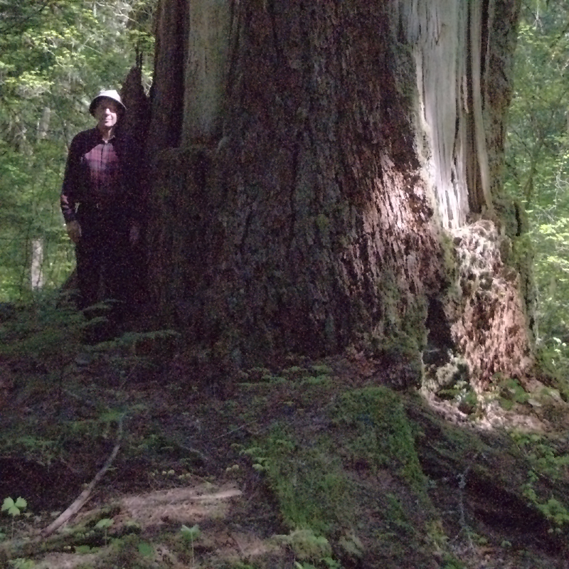
Wrap your arms around this big tree… Ralph Anderson… Big Bottom Wilderness
Ralph Anderson wanted to show me some big trees. We were buddies in high school some 56 years ago. We recently renewed the friendship and found we had a mutual interest in botanical things. Yesterday we set out on an adventure. He knew of a grove of old growth trees where several had nominations as the largest trees in their species. The added attraction for me was the location was on the Clackamas River, one of my favorite drives.
Before you start up the Clackamas, before you leave Estacada, you should do several things. Stop at the Clackamas River Ranger District office and purchase a map of the Mount Hood National Forest. Forest roads can be complicated and a good map could save you from getting lost in a maze of roads. Top off your fuel tank before leaving town. There are no fueling stations for many miles once you leave Estacada and beginning with a full tank may save you a long walk through unpopulated area. It’s also a good idea to have an axe, a shovel, and a bucket in your car. Forest roads are usually not maintained and you may need to clear the path of downed trees or fallen rocks. I usually have drinking water in the car… I buy a carton of those plastic water filled bottles and when I start a hike I put one or two in my backpack. Stay hydrated and your hike will be more enjoyable.
We departed Estacada to the southeast on State Highway (SH) 224, headed up river. Be sure and stop at some of the many pullouts and enjoy the scenic views of the Clackamas River. SH 224 ends just a little past the Ripplebrook Guard Station but the paved road continues as the Primary Forest Route (PFR) 46. Beyond this point the road is not plowed during winter so as elevation increases you may find snowdrifts blocking the route even as late as June. If you find snow I recommend turning around and heading back the way you came. Cell phone coverage ends just a few miles upriver from Estacada so you may be on your own except for occasional travelers or loggers. If you choose to proceed the shovel you put in the car may be useful.
Primary Forest Routes are numbered with two digits. The route we followed after Ripplebrook was PFR 46, a good paved road that eventually ends up at Detroit, over in the Santiam River drainage, on SH 22. Branches (secondary forest routes) have four digit numbers. The branch we were looking for was SFR 4670. After finding our road we crossed the bridge over the Clackamas then turned right on a spur road. From this point it would be a good idea to have a guide to find the big trees. The trail is not well marked, is rough and brushy. We hiked about six miles round trip so you might rate the hike as strenuous. It would be difficult to get lost because you only need to follow the river back upstream to the bridge but for efficiency it is good to be with someone who knows where the trees stand.
The big trees were magnificent. Several species here, notably cedar and fir, have had nominations as the largest of their species. We don’t have many of these big trees left so it is a privilege to visit and marvel at them. You might notice how quiet it is in this grove. Birds seem absent and the only thing that breaks the silence is the ripple of rapids in the Clackamas, the wind in the trees, and the occasional roar of a logging truck using PFR 46. During the hike to the grove we did hear the drumming of grouse and the call of a very vocal owl that we probably disturbed from its daytime snooze.
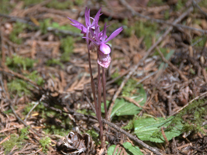
Several spring wildflowers were in bloom, notably a delicate (and small) orchid called a Fairy Slipper (Calypso bulbosa).
Fairy Slipper (Calypso bulbosa) Big Bottom Wilderness


 Ridgefield")
 Ridgefield")
 Ridgefield")

 Ridgefield our smallest Merganser")